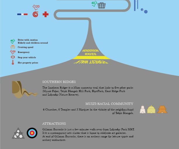
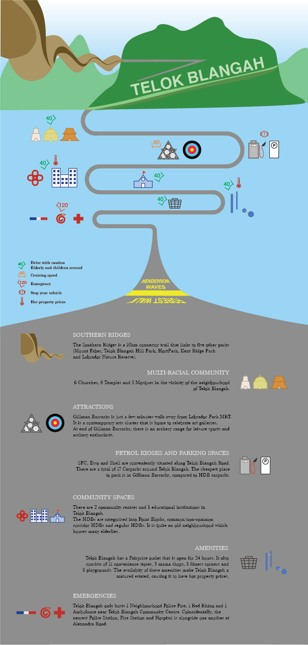
After my exploration around Telok Blangah, I have decided to make an infographic as a guide for drivers (Target Audience). The road the bends around in the middle of the composition brings the audience’s eyes around the context, which will inform them about things in Telok Blangah.
At the top of the composition, there’s the Southern Ridges which includes Henderson Waves, Telok Blangah Hill and Mt Faber. It then leads to temples, Gillman Barracks, petrol kiosks, schools, markets and emergency responses. At the bottom of the composition, I included a short write-up to include information on the icons of the neighbourhood so that they can find out more about the place.
In the middle of the composition, I have included some speed limits to advise drivers to keep while driving past the areas as there are elderlies and children around the neighbourhood. They can increase to cruising speed when they are travelling to attraction sites like Gillman Barracks and archery range. The high speed is to indicate that the emergency responses will travel at a high speed, so drivers should be aware of their surroundings and keep a good lookout to prevent accidents. The “hot temperature” symbol is to indicate that Telok Blangah is a mature estate which offers high property prices even though it is a quiet neighbourhood. I have also included petrol kiosks and parking spaces in the infographic as I find it intriguing to have 3 different petrol kiosks down the same road on Telok Blangah Road. It is very convenient for drivers to find them on the main road.
In conclusion, I find that this Infographic exercise allow us to better appreciate the neighbourhood and know what information we want to bring across to our audience.